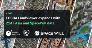
EOSDA LandViewer Expands With 21AT Asia and SpaceWill Data
With the addition of Beijing-3A, Beijing-3N, and two more SuperView satellites, EOSDA LandViewer enhances its satellite imagery collection even further.
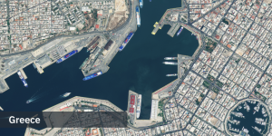
MENLO PARK, CALIFORNIA, UNITED STATES, May 9, 2024 /EINPresswire.com/ -- EOS Data Analytics has announced the integration of historical data from 21AT Asia and SpaceWill satellites into EOSDA LandViewer, its digital analytics satellite-driven tool. This enhancement makes a wide range of high-resolution satellite images available to all platform customers, marking a substantial improvement in the platform's data offerings.The newly added satellite data includes imagery from 21AT Asia's Beijing-3A (BJ3A) and Beijing-3N (BJ3N, previously known as BJ3B) satellites, as well as SpaceWill's SuperView Neo-1 and SuperView-2 satellites. These spacecraft are capable of collecting very high-resolution optical satellite imagery across the globe, ensuring comprehensive coverage for EOSDA LandViewer users.
The imagery is particularly useful for applications in geospatial mapping, agriculture, forestry, environmental monitoring, infrastructure development, disaster management, and telecommunications, offering valuable insights for planning, monitoring, and response efforts in these critical areas.
"Our goal is to make Earth imagery accessible broadly, enabling businesses and governments to derive data-driven insights for the growth and sustainability of critical industries and contribute to sustainable practices and environmental monitoring. This addition of 21AT Asia and SpaceWill satellites to our platform is a step forward in our mission to provide comprehensive and accurate geospatial data," says Viktoriia Troian, EOSDA LandViewer Product Manager at EOS Data Analytics.
The 21AT Asia satellites, including Beijing-3A and Beijing-3N (formerly known as Beijing-3B), provide pansharpened images with resolutions of 50 cm and 30 cm, respectively. Native resolutions of multispectral bands are 2 m for Beijing-3A and 1.20 m for Beijing-3N. The satellites boast a revisit rate of approximately 4 to 5 days and can cover areas from 25 km², offering users up-to-date and detailed imagery.
Similarly, SpaceWill's satellites have a daily revisit capacity. SuperView Neo-1 and SuperView-2 provide pansharpened images with a resolution of better than 50 cm (the native resolution of multispectral bands is 1.2 m for SuperView Neo-1 and 1.68m for SuperView-2). Such capabilities further enhance the platform's potential for stereo imaging and high-agility operations.
Previously, EOSDA LandViewer users obtained access to TripleSat data from 21AT Asia and imagery from SpaceWill's SuperView-1, Gaofen-1, Gaofen-2, and Ziyuan-3 satellites. The integration of additional satellites from these providers further enriches the platform's extensive satellite imagery database.
Looking ahead, the EOSDA LandViewer team plans to introduce tasking capabilities for its customers in 2024, specifically for the newly integrated satellites — Beijing-3A, Beijing-3N (formerly Beijing-3B), SuperView Neo-1, and SuperView-2. This will allow for even more personalized and specific data collection requests tailored to the unique needs and requirements of customers.
***
About EOSDA LandViewer
EOSDA LandViewer is a digital satellite-driven tool created by EOS Data Analytics (EOSDA), a global provider of AI-powered satellite imagery analytics. The service allows for on-the-fly searching, visualizing, and processing of data by applying more than 10 indices available on the platform and extracting insights from satellite data to tackle real business tasks and challenges.
The software allows users to get free access to medium-resolution images (10 free images per day) and, thus, serves as a catalog of satellite imagery obtained from multiple data sources. Users can find images of any AOI (area of interest) all around the globe and process them - all in one tool. A processed image can be easily downloaded whenever needed, saving time and storage space on the device.
You can easily detect the change by comparing various images of the same AOI taken by multiple satellites, on different dates, and even at a different time of day, using the split view mode and time series analysis, and visualize the results as a time-lapse animation. In addition to default indices, users have an opportunity to create custom indices by applying different combinations of spectral bands.
EOS Data Analytics Press Office
EOS Data Analytics, Inc.
pr@eosda.com
Visit us on social media:
Facebook
Twitter
LinkedIn
YouTube
EIN Presswire does not exercise editorial control over third-party content provided, uploaded, published, or distributed by users of EIN Presswire. We are a distributor, not a publisher, of 3rd party content. Such content may contain the views, opinions, statements, offers, and other material of the respective users, suppliers, participants, or authors.


